
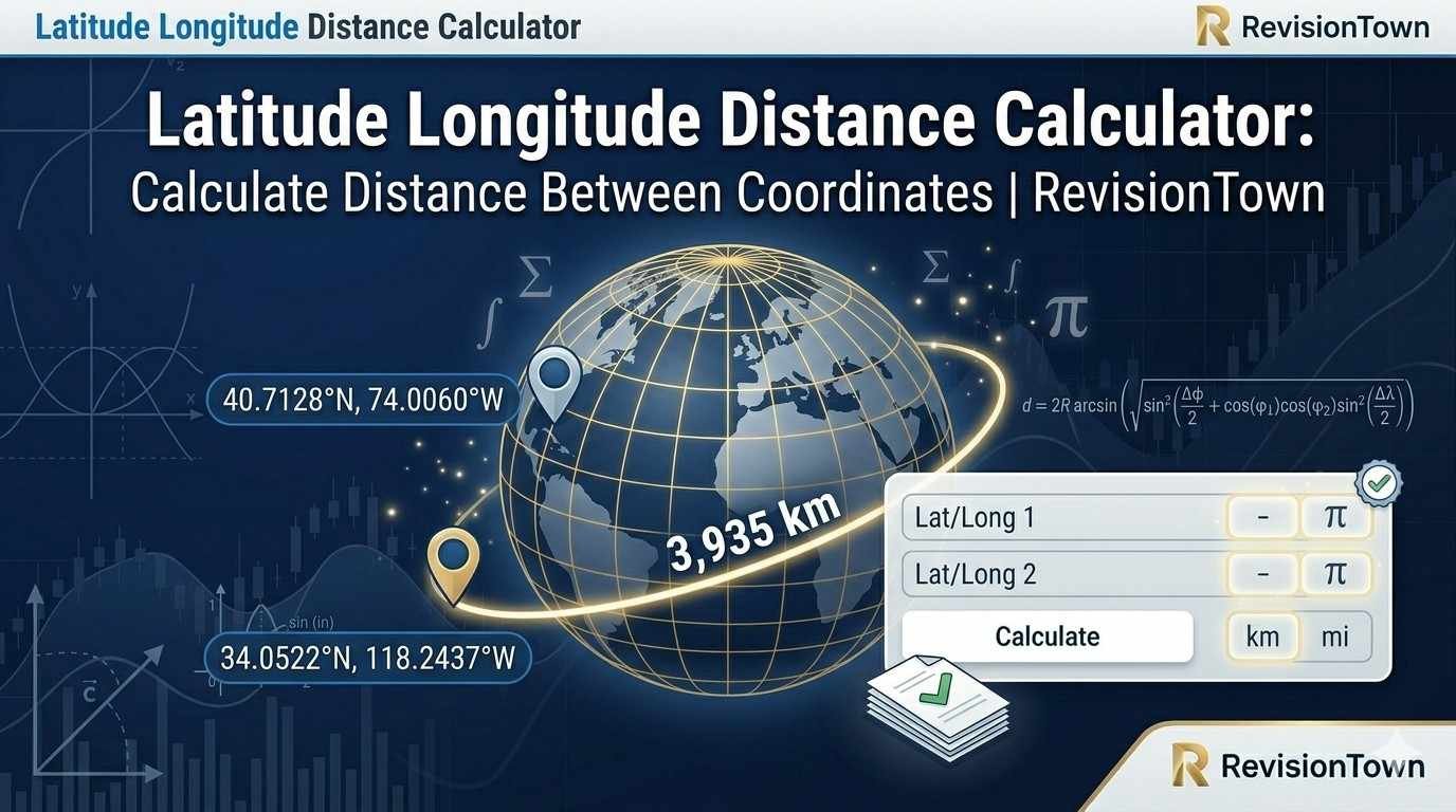
Latitude Longitude Distance Calculator: Calculate Distance Between Coordinates
Use this latitude longitude distance calculator to find the great-circle distance between two GPS coordinate points. Enter decimal latitude and longitude values, calculate distance in kilometers, miles, nautical miles, and meters, and review the initial bearing, midpoint, and coordinate formulas used behind the result.
Calculate Distance Between Coordinates
Enter coordinates in signed decimal degrees. Use positive latitude for north, negative latitude for south, positive longitude for east, and negative longitude for west.
Example: New York City is approximately \(40.7128^\circ, -74.0060^\circ\). Los Angeles is approximately \(34.0522^\circ, -118.2437^\circ\).
Result
Enter valid latitude and longitude values to calculate a coordinate distance.
What This Latitude Longitude Distance Calculator Does
A latitude longitude distance calculator estimates the shortest surface distance between two positions identified by latitude and longitude. The result is not a flat ruler distance on a printed map. It is a curved-surface distance along the Earth, usually called a great-circle distance when the Earth is treated as a sphere. This is the distance most people want when they enter GPS coordinates, compare city coordinates, estimate a flight route, check the approximate separation between two field locations, or calculate how far one coordinate point is from another.
The calculator above uses the Haversine formula, a standard spherical-distance formula that works well for navigation, education, travel planning, mapping prototypes, logistics estimates, and general GPS work. It converts latitude and longitude from degrees to radians, calculates the central angle between the two points, and multiplies that angle by an Earth radius value. The default radius is the mean Earth radius \(R=6{,}371.0088\,\text{km}\). You can also switch to a rounded, equatorial, or polar radius to see how the radius assumption affects the answer.
This page is focused on geographic distance between latitude-longitude coordinate pairs. If you are working with ordinary Cartesian coordinates such as \((x_1,y_1)\) and \((x_2,y_2)\), use RevisionTown's 2D distance calculator. If your points include \(x\), \(y\), and \(z\) coordinates in space, use the 3D distance calculator. Those tools use flat coordinate geometry, while this calculator is for positions on the Earth's curved surface.
Latitude and Longitude Basics
Latitude measures how far north or south a point is from the equator. It ranges from \(-90^\circ\) at the South Pole to \(+90^\circ\) at the North Pole. The equator is \(0^\circ\) latitude. Longitude measures how far east or west a point is from the Prime Meridian. It ranges from \(-180^\circ\) to \(+180^\circ\), with \(0^\circ\) longitude running through Greenwich, England. In signed decimal coordinates, north and east are positive, while south and west are negative.
For example, New York City is commonly written as approximately \(40.7128^\circ\text{ N}, 74.0060^\circ\text{ W}\). In signed decimal form, that becomes \(40.7128, -74.0060\). Sydney, Australia is about \(33.8688^\circ\text{ S}, 151.2093^\circ\text{ E}\), which becomes \(-33.8688, 151.2093\). This signed format is the easiest format for formulas because the signs tell the calculation which hemisphere each coordinate belongs to.
Latitude is usually written before longitude. A common input pattern is latitude, longitude. Swapping the order is a serious error because a valid latitude must be between \(-90^\circ\) and \(+90^\circ\), while longitude can extend to \(\pm180^\circ\). A coordinate pair such as \(51.5074, -0.1278\) points near London. If it is reversed as \(-0.1278, 51.5074\), it points to a completely different part of the world.
Coordinates may appear in decimal degrees, degrees and decimal minutes, or degrees-minutes-seconds. This calculator expects decimal degrees. If a coordinate is written as \(40^\circ 42' 46''\), convert it to decimal degrees before entering it. The conversion is:
For west longitudes and south latitudes, apply the negative sign after converting the magnitude. Clear formatting matters because distance formulas are very sensitive to hemisphere signs.
The Haversine Formula
The Haversine formula calculates the central angle between two points on a sphere. Once that central angle is known, the distance is found by multiplying by the sphere's radius. The formula is popular because it is stable for small distances and straightforward to implement in calculators, spreadsheets, and code.
Let the first point be \((\phi_1,\lambda_1)\) and the second point be \((\phi_2,\lambda_2)\), where \(\phi\) represents latitude and \(\lambda\) represents longitude. Angles must be in radians when used inside sine and cosine functions:
In these equations, \(R\) is the Earth radius, \(c\) is the central angle in radians, and \(d\) is the surface distance. The calculator reports \(d\) in kilometers, miles, nautical miles, and meters. The distance in miles is calculated from kilometers using:
The distance in nautical miles is calculated using:
The Haversine formula assumes a spherical Earth. The real Earth is an oblate spheroid, meaning it is slightly wider at the equator than at the poles. For ordinary distance estimates, the spherical assumption is usually good enough. For land surveying, legal boundary work, engineering-grade geodesy, and precise long-distance measurements, specialized ellipsoidal methods and professional data sources are more appropriate.
Degrees to Radians
Trigonometric functions in mathematical formulas normally use radians. Most coordinate values are written in degrees. Therefore, the calculator converts every latitude and longitude value from degrees to radians before using the Haversine formula. The conversion is:
For example, a latitude of \(40.7128^\circ\) becomes:
This step is easy to overlook when manually coding a coordinate distance calculator. If degrees are placed directly into sine and cosine functions that expect radians, the answer will be wrong. A result that looks plausible may still be wrong by a large amount, so the degree-to-radian conversion should always be visible in the calculation process.
If you need a general-purpose calculator for trigonometric work outside this coordinate-distance context, RevisionTown's scientific calculator is useful for checking sine, cosine, tangent, inverse trigonometric functions, and angle conversions. The important point here is that the coordinate-distance formula is not only a geography formula; it is also a spherical trigonometry calculation.
Step-by-Step Example: New York City to Los Angeles
Suppose you want to estimate the distance from New York City to Los Angeles using approximate city-center coordinates. Use:
- New York City: \(40.7128^\circ, -74.0060^\circ\)
- Los Angeles: \(34.0522^\circ, -118.2437^\circ\)
First convert all angles to radians:
Then calculate the latitude and longitude differences:
Substitute these values into the Haversine expression for \(a\), calculate \(c\), then multiply by the Earth radius. With the mean Earth radius, the great-circle distance is approximately:
In miles, that is about:
The exact result can vary slightly depending on the coordinate source, whether city centers or airports are used, and which Earth radius model is selected. That variation is normal. The key idea is that the formula finds the curved-surface distance between coordinate points, not the driving route, not the walking route, and not a straight line through the Earth.
Great-Circle Distance vs Driving Distance
Great-circle distance is the shortest path along a spherical surface. It is useful for aviation, maritime planning, global distance estimates, geospatial analysis, and educational coordinate problems. Driving distance is different. Roads curve around terrain, follow property boundaries, cross bridges, avoid restricted zones, and connect through available road networks. A great-circle distance between two cities can be much shorter than the driving distance.
For example, two coordinates may be separated by \(100\,\text{km}\) as a great-circle distance, but the road route may be \(130\,\text{km}\) because it follows highways, avoids mountains, or crosses a river at a bridge. A coordinate distance calculator cannot know road access, traffic, ferry schedules, border crossings, or local route restrictions. It answers the geometric distance question: how far apart are these two positions on the Earth?
This distinction matters for trip planning. Use great-circle distance for rough separation, flight-style comparison, or coordinate geometry. Use a routing engine for actual travel distance and estimated time. If your task is to convert a distance value after calculating it, use the length converter to move between kilometers, miles, meters, feet, and other length units. Unit conversion and route finding are different tasks.
Great-Circle Distance vs 2D Coordinate Distance
Flat 2D distance uses the Pythagorean theorem:
That equation is correct for points on a flat Cartesian plane. It is not the correct default formula for latitude and longitude over the Earth because longitude lines get closer together near the poles and because the Earth is curved. One degree of longitude does not represent the same ground distance everywhere. Near the equator, one degree of longitude is roughly \(111\,\text{km}\). Near high latitudes, the same one-degree longitude difference covers much less ground.
For small local areas, a projected coordinate system can convert geographic coordinates into a flat coordinate plane, and then a 2D formula may be acceptable. Surveyors, GIS analysts, and engineers often use map projections for local work. But raw latitude and longitude are angular coordinates, not flat \(x,y\) distances. If you have ordinary \(x,y\) points, use the 2D distance calculator. If you have GPS latitude and longitude, use the Haversine-based tool on this page.
The same logic applies in three dimensions. A point written as \((x,y,z)\) in a 3D coordinate system is not the same thing as a latitude-longitude coordinate on Earth. If your problem involves height, depth, or a 3D Cartesian coordinate, use a proper space-distance method such as RevisionTown's 3D distance calculator. This page is intentionally focused on surface distance between geographic coordinate pairs.
Initial Bearing and Compass Direction
Bearing tells the direction from the first coordinate to the second coordinate. It is measured clockwise from true north. A bearing of \(0^\circ\) points north, \(90^\circ\) points east, \(180^\circ\) points south, and \(270^\circ\) points west. The calculator reports the initial bearing, which is the direction you would start traveling along the great-circle route from point 1 toward point 2.
The initial bearing formula is:
The angle from \(\operatorname{atan2}\) is then converted from radians to degrees and normalized into the range \(0^\circ\) to \(360^\circ\):
Great-circle routes usually do not maintain a constant bearing from start to finish. The initial bearing and final bearing can differ, especially over long distances. That is why aircraft and navigation systems update direction along the route. A rhumb line, by contrast, keeps a constant bearing but is usually longer than the great-circle path.
Compass direction labels such as northeast or southwest are simplified descriptions. A bearing of \(247^\circ\) is more precise than saying "west-southwest." The label is helpful for a quick human reading, but the numeric bearing is better for navigation calculations. This calculator gives a bearing estimate so the distance result has directional context.
Midpoint Between Two Coordinates
The midpoint between two latitude-longitude points on a sphere is not found by simply averaging the two latitudes and averaging the two longitudes, except in limited simple cases. A spherical midpoint should account for the Earth's curved surface. The calculator estimates the midpoint along the great-circle path.
One common midpoint method uses:
The result is converted back to degrees. The calculator reports a midpoint latitude and longitude so you can see the approximate halfway coordinate along the great-circle route. The midpoint can be useful for route comparison, map labeling, classroom examples, and quick geospatial analysis.
For short distances, an arithmetic average may look very close to the spherical midpoint. For longer routes, routes crossing high latitudes, and routes near the International Date Line, the difference can become more noticeable. If midpoint accuracy matters, use a spherical or ellipsoidal method rather than simple coordinate averaging.
Coordinate Distance Units
The calculator reports several units because different fields use different distance conventions. Kilometers are common in science, geography, international travel, and most metric contexts. Miles are common for road-distance discussion in the United States and some other settings. Nautical miles are standard in aviation and maritime navigation because one nautical mile is historically tied to one minute of latitude.
| Unit | Conversion from kilometers | Common use |
|---|---|---|
| Kilometers | \(d_{\text{km}}=d_{\text{km}}\) | Geography, science, international route estimates |
| Meters | \(d_{\text{m}}=d_{\text{km}}\times1{,}000\) | Shorter field distances, technical reports, local GIS work |
| Miles | \(d_{\text{mi}}=d_{\text{km}}\times0.621371\) | Road-distance discussions, regional planning in mile-based systems |
| Nautical miles | \(d_{\text{NM}}=d_{\text{km}}\times0.539957\) | Aviation, maritime navigation, charts, voyage planning |
Do not mix distance units with coordinate units. Latitude and longitude are angles. Kilometers, miles, nautical miles, and meters are lengths. The formula turns angular separation into length by multiplying by Earth radius. If the Earth radius is in kilometers, the first distance result is in kilometers. If the Earth radius were expressed in miles, the first result would be in miles.
Earth Radius Choices and Accuracy
The Earth is not a perfect sphere. It is slightly flattened at the poles and wider at the equator. That means there is no single radius that is perfect for every calculation. A spherical formula must choose a radius, and that choice slightly affects the final distance. The default mean Earth radius is a practical compromise for general distance calculations.
| Radius option | Value | When it is useful |
|---|---|---|
| Mean Earth radius | \(6{,}371.0088\,\text{km}\) | Good default for general Haversine distance calculations |
| Rounded Earth radius | \(6{,}371\,\text{km}\) | Simple classroom and hand-calculation examples |
| Equatorial radius | \(6{,}378.137\,\text{km}\) | Useful for seeing the effect of a larger radius assumption |
| Polar radius | \(6{,}356.752\,\text{km}\) | Useful for seeing the effect of a smaller radius assumption |
For many real-world uses, errors from coordinate source quality, rounding, route definition, and location selection are larger than the error caused by using a mean spherical radius. If you enter city-center coordinates rounded to four decimal places, the exact city-center definition may matter more than the radius model. If you enter a phone GPS coordinate, device precision, signal environment, and map-matching assumptions can also matter.
For professional surveying and legal boundaries, do not rely on a general online Haversine calculator as the final authority. Use official geodetic methods, datum-aware GIS tools, and qualified professionals. This calculator is designed for education, estimation, navigation-style comparison, and practical coordinate-distance understanding.
Haversine vs Vincenty
The Haversine formula treats Earth as a sphere. Vincenty-style calculations treat Earth as an ellipsoid. The ellipsoidal approach is more accurate for geodesic work because it accounts for Earth's flattening. However, it is also more complex and can require iterative calculation. For everyday coordinate-distance questions, Haversine is usually easier to understand and sufficiently accurate.
The choice depends on purpose. A student learning spherical trigonometry, a traveler comparing city separation, or a developer building a quick map feature may use Haversine. A surveyor, cartographer, geodesist, or engineer working with legal boundaries should use ellipsoidal methods and a defined geodetic datum. The calculator on this page is transparent about the spherical model so users can decide whether it matches the level of precision they need.
One useful way to think about the difference is that Haversine answers "roughly how far apart are these latitude-longitude points on Earth?" Vincenty and other ellipsoidal geodesic methods answer "what is the more precise geodesic distance on a specified ellipsoid?" The first question is common and practical. The second is specialized and precision-sensitive.
Coordinate Formats: Decimal Degrees and DMS
Many GPS tools use decimal degrees, such as \(25.2048, 55.2708\). Many maps and older navigation references use degrees-minutes-seconds, such as \(25^\circ12'17.3''\text{ N}\). Both formats describe the same type of angular position, but formulas usually require decimal degrees before converting to radians.
To convert degrees-minutes-seconds to decimal degrees, use:
For example:
If the coordinate is west or south, make the final decimal value negative. A longitude of \(74^\circ0'21.6''\text{ W}\) becomes approximately \(-74.0060^\circ\). Do not make each component negative separately in a way that creates confusion. Convert the magnitude, then apply the hemisphere sign.
Decimal minutes use a similar idea. A coordinate such as \(40^\circ42.768'\) becomes \(40+42.768/60=40.7128^\circ\). When using coordinate data from a device, map, or survey note, confirm the format before entering the numbers. Entering DMS values as if they were decimal degrees can place the point in the wrong location.
Worked Examples
Example 1: Two Nearby Points
Suppose point A is \(51.5007, -0.1246\) and point B is \(51.5014, -0.1419\). These points are both in central London. Because the two points are close, the great-circle distance will be small. The Haversine formula still works, but the result will be easier to interpret in meters than in kilometers.
The calculator first finds the central angle, then multiplies by the selected Earth radius. A short distance such as this may be reported as a small fraction of a kilometer. To convert kilometers to meters, multiply by \(1{,}000\):
For local field work, coordinate precision matters. A coordinate rounded to four decimal places corresponds to roughly 11 meters of latitude precision, while five or six decimal places give finer resolution. If your input coordinates are rounded heavily, do not overstate the precision of the distance result.
Example 2: A Cross-Country Distance
For a longer route such as Chicago to Miami, the great-circle distance gives an air-distance estimate. It does not represent the road trip distance. The distance result is useful for comparing separation, flight planning examples, and broad geography questions. The difference between great-circle distance and driving distance can be hundreds of kilometers because the road network cannot follow the shortest spherical path exactly.
If the coordinates are \(41.8781, -87.6298\) for Chicago and \(25.7617, -80.1918\) for Miami, the calculator produces a distance near the air-route separation between the two city centers. If a travel site gives a different road mileage, both answers can be correct because they answer different questions.
Example 3: Crossing the International Date Line
Coordinates near \(+180^\circ\) and \(-180^\circ\) longitude can look far apart numerically even when they are geographically close. For example, a point at \(10^\circ, 179.8^\circ\) and another at \(10^\circ, -179.8^\circ\) are close across the International Date Line. A good spherical distance formula handles this because sine and cosine functions account for angular wraparound.
Manual reasoning can fail here if you subtract longitudes and treat the difference as an ordinary flat number without considering wraparound. The direct longitude difference is \(-359.6^\circ\), but the shorter separation across the date line is \(0.4^\circ\). Trigonometric formulas help avoid this mistake when implemented correctly.
Common City Distance Reference
The following examples use approximate city-center coordinates and a spherical Earth model. They are useful for checking whether a result is in a reasonable range, not for legal, aviation-dispatch, or route-planning authority.
| Coordinate pair | Approximate great-circle distance | Why the example is useful |
|---|---|---|
| New York City to Los Angeles | About \(3{,}936\,\text{km}\) | Classic cross-country U.S. coordinate example |
| London to Paris | About \(344\,\text{km}\) | Short international city-pair comparison |
| Dubai to London | About \(5{,}500\,\text{km}\) | Longer intercontinental air-distance estimate |
| Sydney to Auckland | About \(2{,}160\,\text{km}\) | Southern Hemisphere longitude-latitude example |
| Tokyo to Singapore | About \(5{,}300\,\text{km}\) | Asia-Pacific coordinate-distance example |
Different coordinate sources can move these values slightly because "London" may mean a city center, an airport, a station, or a metropolitan reference point. Always define the actual coordinate pair if precision matters. A coordinate-distance calculator works with points, not vague place names.
Practical Uses
Coordinate distance appears in many fields because latitude and longitude provide a common language for location. A shipping analyst, geography student, app developer, drone hobbyist, field researcher, and traveler may all ask the same basic question: how far apart are these two coordinates? The answer can support decisions, but it should be interpreted in the context of the task.
How to Enter Coordinates Correctly
Use signed decimal degrees. Enter north latitudes as positive numbers and south latitudes as negative numbers. Enter east longitudes as positive numbers and west longitudes as negative numbers. Keep latitude in the latitude field and longitude in the longitude field. Confirm that latitude is between \(-90\) and \(90\). Confirm that longitude is between \(-180\) and \(180\).
Do not include letters such as N, S, E, or W in the number fields. Convert them to signs instead. For example, \(33.8688^\circ\text{ S}\) becomes \(-33.8688\). \(151.2093^\circ\text{ E}\) becomes \(151.2093\). \(118.2437^\circ\text{ W}\) becomes \(-118.2437\).
If your source gives coordinates with commas, check whether the comma separates latitude and longitude or is part of a local number format. In most coordinate lists, a comma separates the two values: 40.7128, -74.0060. In some countries, a comma may be used as a decimal separator, which can create confusion. For this calculator, use a period as the decimal separator.
Coordinate precision should match the purpose. For a city-to-city estimate, four decimal places may be enough. For field measurements, more decimals may be needed. As a rough guide, one decimal degree of latitude is about \(11.1\,\text{km}\), two decimals about \(1.11\,\text{km}\), three decimals about \(111\,\text{m}\), four decimals about \(11.1\,\text{m}\), and five decimals about \(1.11\,\text{m}\). Longitude precision varies with latitude because longitude lines converge near the poles.
Common Mistakes to Avoid
- Swapping latitude and longitude: Latitude comes first in this calculator. Longitude comes second.
- Forgetting negative signs: West longitudes and south latitudes should be negative in signed decimal format.
- Entering DMS as decimal degrees: Convert degrees-minutes-seconds before entering the value.
- Expecting driving distance: The calculator gives great-circle distance, not road distance.
- Using flat distance formulas for global coordinates: Latitude and longitude are angular coordinates on a curved surface.
- Overstating precision: Rounded coordinates cannot produce highly precise real-world distances.
- Ignoring datum and source differences: Coordinates from different systems or approximations may not represent exactly the same point.
The most common user error is a missing negative sign for western longitudes. For example, Los Angeles is approximately \(-118.2437^\circ\), not \(+118.2437^\circ\). A positive longitude would place the point in the Eastern Hemisphere, producing a completely different distance. When a result is thousands of kilometers away from expectation, check the longitude signs first.
Using the Calculator for GPS, Maps, and Apps
GPS coordinates from phones, cameras, trackers, and mapping tools are usually decimal latitude and longitude values. If the values are copied exactly, the calculator can provide a quick distance estimate between two recorded positions. This is useful when checking the separation between photos, comparing field observations, estimating distance between delivery points, or testing location-based application logic.
App developers often need a fast distance estimate for features such as "nearby locations," store finders, simple geofencing, or map clustering. Haversine is commonly used as a first-pass filter because it is easy to implement and does not require a map-routing service. For example, an app might first find all stores within \(50\,\text{km}\) by Haversine distance, then use a routing API only for the few nearest stores.
For high-volume applications, developers often combine bounding-box filtering with Haversine calculation. The bounding box quickly removes far-away points based on latitude and longitude ranges. Haversine then calculates a more accurate spherical distance for the remaining candidates. This workflow is efficient because it avoids applying trigonometric calculations to every point in a large database.
For education and manual checking, the formula shown on this page is more important than the implementation details. Students should understand that coordinates are angles, radians are required, and Earth radius turns the central angle into distance. That conceptual chain explains why the calculator works.
Distance, Bearing, and Midpoint in One Workflow
A coordinate pair often requires more than one answer. Distance tells how far apart the two points are. Bearing tells the starting direction from one point to the other. Midpoint gives an approximate coordinate halfway along the great-circle path. Together, these outputs provide a compact geographic summary.
For example, if a field researcher records two observation points, distance tells how far apart the observations are. Bearing gives the direction from the first observation to the second. Midpoint can help place a label or plan a rough intermediate check. If a logistics analyst compares two depots, the distance helps estimate separation while the midpoint gives a rough central area for visualization.
The three outputs should not be confused with a complete route. A route includes roads, paths, airways, shipping lanes, restricted zones, terrain, and operational constraints. A coordinate calculator provides geometry. A routing system provides a path through a network. Both are useful, but they solve different problems.
When to Use Another RevisionTown Tool
Use this page when your inputs are latitude and longitude coordinates and you need an Earth-surface distance. Use the 2D distance calculator when your points are flat coordinate pairs such as \((3,4)\) and \((10,12)\). Use the 3D distance calculator when your points include a third coordinate such as height or depth in a Cartesian coordinate system.
If your result needs a different length unit, use the length converter after calculating the distance. If you are checking trigonometric values or angle conversions by hand, the scientific calculator can support the sine, cosine, square root, and inverse tangent steps. For broader trigonometry practice, RevisionTown also has a trigonometry calculator, but raw latitude-longitude distance should stay on this Haversine-focused page.
Advanced students working with polar-coordinate curves may also find polar coordinates and slopes of curves useful, but that topic is a mathematics topic about polar graphs rather than GPS coordinates on Earth. Keeping these topics separate helps each page rank for its own intent without competing for the same calculator query.
Manual Calculation Checklist
When calculating latitude-longitude distance manually, use a consistent process. First, write the coordinates in signed decimal degrees. Second, convert each coordinate to radians. Third, find \(\Delta\phi\) and \(\Delta\lambda\). Fourth, calculate \(a\) using the Haversine formula. Fifth, calculate \(c=2\operatorname{atan2}(\sqrt{a},\sqrt{1-a})\). Sixth, multiply by Earth radius. Seventh, convert the distance unit only after the base distance has been calculated.
That sequence prevents several common mistakes. It separates coordinate formatting from trigonometry. It prevents degree inputs from being used directly in radian formulas. It also separates distance calculation from unit conversion. If the final result looks suspicious, each step can be checked individually.
For a quick reasonableness check, remember that one degree of latitude is roughly \(111\,\text{km}\). If two points differ by only \(0.01^\circ\) of latitude and have nearly the same longitude, the distance should be close to \(1.11\,\text{km}\). If the calculator gives \(111\,\text{km}\), a decimal place was likely entered incorrectly. If it gives \(0.011\,\text{km}\), the coordinate precision or unit conversion should be checked.
Precision and Rounding
The calculator displays results with practical rounding. A distance of \(3{,}935.746254\,\text{km}\) is usually more detail than a user needs if the coordinates are approximate city centers. Rounding to two decimals or one decimal is often enough. For local field points, meters may be more meaningful, but the coordinate precision must support that level of detail.
Do not present a result with more confidence than the input allows. If a location is known only as a city name, the coordinates may represent a city center, administrative boundary, airport, or arbitrary map label. If a GPS device gives six decimal places but the signal was poor, the real-world uncertainty may still be several meters or more. Mathematical precision and measurement accuracy are not the same thing.
For reports, state the method and rounding. A clear sentence is: "Distance was estimated using the Haversine formula with mean Earth radius \(6{,}371.0088\,\text{km}\)." This makes the result transparent. If a different radius or ellipsoidal method is required, the method can be updated without ambiguity.
Latitude and Longitude in Spreadsheets
Coordinate distances can be calculated in spreadsheets, but the formulas are easier to manage when columns are clearly labeled. Use headings such as lat1_deg, lon1_deg, lat2_deg, lon2_deg, lat1_rad, and distance_km. Clear labels prevent unit confusion when formulas are copied across many rows.
A spreadsheet formula should convert degrees to radians before applying trigonometric functions. Many spreadsheet programs provide a RADIANS() function. The overall structure is still the same: calculate \(\Delta\phi\), calculate \(\Delta\lambda\), compute \(a\), compute \(c\), then multiply by \(R\). For large datasets, calculate intermediate columns first while checking the method, then combine formulas only after the logic is verified.
When using spreadsheet coordinates, watch for automatic formatting. Negative signs can be lost when data is imported, coordinate pairs can be split incorrectly, and long decimals can be rounded by display settings. Check a few rows manually with the calculator above before relying on a full spreadsheet output.
Latitude Longitude Distance in Code
A Haversine function in code should make units explicit. Variable names such as lat1Deg, lat1Rad, and distanceKm are safer than short names such as x and d. Coordinates are not ordinary \(x,y\) values, and the formula is easier to maintain when angle units are visible in the names.
The core logic is:
In production code, validate input ranges. Latitude outside \([-90,90]\) is invalid. Longitude outside \([-180,180]\) may need normalization or rejection depending on the application. Also decide whether altitude matters. This page calculates surface distance, not 3D slant distance between elevated objects.
For nearest-location searches, Haversine distance is often used after a preliminary bounding-box filter. For route distance, use a routing service. For legal or survey-grade geodesy, use a geospatial library that supports ellipsoids and datums. The right method depends on the question being asked.
Reporting Coordinate Distance Results Clearly
A good coordinate-distance result should state the two input points, the method, the unit, and any important assumption. A concise report might say: "Using the Haversine formula with mean Earth radius \(6{,}371.0088\,\text{km}\), the great-circle distance from \(40.7128,-74.0060\) to \(34.0522,-118.2437\) is approximately \(3{,}935.75\,\text{km}\)." That sentence tells the reader exactly what was calculated. It also makes clear that the result is a great-circle estimate rather than a road route.
For classroom work, show the formula and at least one substitution step. For a spreadsheet, include labeled columns for input coordinates and output units. For a map note, identify whether the point represents a city center, airport, address, landmark, or recorded GPS position. For a logistics estimate, avoid presenting the great-circle distance as a delivery mileage unless the workflow explicitly uses straight-line distance as a proxy.
When comparing multiple coordinate pairs, use the same radius model and rounding rule for all rows. Mixing a rounded Earth radius in one row and a mean Earth radius in another row can create small inconsistencies that are hard to explain later. Likewise, do not round one result to the nearest kilometer and another to the nearest meter unless the input precision justifies that difference. Consistent reporting is especially important when distances are ranked from nearest to farthest.
If the result will influence money, safety, compliance, field operations, or legal decisions, treat this calculator as an estimation and learning tool. Confirm the coordinates, method, datum, and operational route with the appropriate professional system. The calculator is excellent for understanding distance between coordinates, checking calculations, and building intuition, but a general Haversine result is not a substitute for certified surveying, aeronautical dispatch, maritime passage planning, or regulated navigation procedures.
Quick Troubleshooting Guide
If the distance result is much larger than expected, first check the signs. A missing negative sign on a western longitude can move the point across the globe. Next, check the coordinate order. Latitude should be in the latitude field and longitude in the longitude field. Then check the coordinate format. Degrees-minutes-seconds values must be converted to decimal degrees before entry.
If the distance is smaller than expected, check whether both points accidentally use the same coordinate, whether one longitude was rounded too aggressively, or whether the two points are actually close in great-circle terms even though the road route is long. Islands, rivers, mountains, and road networks can make travel distance very different from geometric distance. A straight-line surface estimate is a useful comparison, but it does not know obstacles or transport networks.
FAQ
How do I calculate distance between two latitude and longitude points?
Convert the latitude and longitude values from degrees to radians, apply the Haversine formula to find the central angle, then multiply by an Earth radius. The calculator on this page performs those steps and returns kilometers, miles, nautical miles, meters, bearing, and midpoint.
What formula does this coordinate distance calculator use?
It uses the Haversine formula: \(a=\sin^2(\Delta\phi/2)+\cos(\phi_1)\cos(\phi_2)\sin^2(\Delta\lambda/2)\), \(c=2\operatorname{atan2}(\sqrt{a},\sqrt{1-a})\), and \(d=Rc\).
Is the result a driving distance?
No. The result is a great-circle surface distance between coordinate points. Driving distance depends on roads, traffic rules, terrain, and available routes, so it can be much longer than the great-circle distance.
Why are west longitudes negative?
Signed decimal coordinates use positive values for east longitudes and negative values for west longitudes. This convention lets formulas handle hemispheres consistently without separate E/W text labels.
Can I use the Pythagorean theorem for latitude and longitude?
Not for raw geographic coordinates over the Earth. The Pythagorean theorem works on a flat plane. Latitude and longitude are angular coordinates on a curved surface, so a spherical formula such as Haversine is usually needed.
How accurate is the Haversine distance?
Haversine is accurate enough for many educational, mapping, travel, and general GPS estimates, but it assumes a spherical Earth. For survey-grade or legal boundary work, use ellipsoidal geodesic methods and authoritative coordinate data.
What is the difference between miles and nautical miles?
A statute mile is used in common land-distance contexts, while a nautical mile is used in aviation and maritime navigation. This calculator reports both because coordinate distance is often used in travel, aircraft, and marine contexts.
What coordinate format should I enter?
Enter signed decimal degrees, such as \(40.7128, -74.0060\). Convert degrees-minutes-seconds to decimal degrees before entering coordinates.
Does altitude affect the result?
This calculator estimates surface distance between latitude-longitude points. It does not include altitude difference. For most city and map-distance estimates that is appropriate, but 3D engineering calculations require a different model.
Why do different calculators give slightly different distances?
Differences can come from coordinate sources, Earth radius assumptions, rounding, spherical versus ellipsoidal formulas, and whether the points represent city centers, airports, landmarks, or exact GPS readings.